Thursday, August 21, 2014

Sandy - the City


The City of Sandy has fewer than 10,000 residents, and is known to most only as a small city through which Highway 26 goes through on the way to Mt. Hood and points east. And, truth be told, while Sandy looks like a nice place to live for its residents, there is not a lot to see here. But there are a few things in the "downtown" area that are worth a walk. And this short 1.2 mile trek, with a bit of up and down terrain, would provide a nice little stop for someone wanting to see something new on the way elsewhere to more familiar sights.


The walk starts at the main parking lot of Meinig Memorial Park, established on this site in 1963. To get to the parking lot turn right from Highway 26 (Pioneer Blvd.) onto Highway 211, and then left onto Meinig Road. The parking lot is a few hundred feet down the road on the left.


From the parking lot start walking east, away from Meinig Road, along a forested pathway. The park has some nice covered picnic shelters and this wooden bandstand, where small concerts take place occasionally.


The trail has both left and right turns, but continue straight until you reach the east end of the park at McCormick Drive. Continue onto the street and go one block to Wolf Drive, where you will turn left and go one block to State Route 26, the Mt. Hood Highway. You will reach the roadway at a point where a one-way couplet system of Pioneer Blvd. and Proctor Blvd. ends and turns back into a two-way highway headed eastward to Mt. Hood. Turn left onto Pioneer Blvd. and head back west.


The road has a nice sidewalk, but also a lot of traffic. While the one-way couplet system certainly speeds traffic through Sandy, it has had a negative impact upon the city's downtown cohesiveness - as is usually the case with such one-way couplets installed to speed the flow of traffic. Soon on the left is the Sandy City Hall, a nice northwest contemporary structure with this interesting mural in the front.


Soon after Sandy City Hall, also on the left, is Joe's Doughnut Shop, a well-known stop for skiiers with a sweet tooth before or after their day on the Mt. Hood slopes.


Continue down Pioneer Blvd. The block on the north (right) side of the street contained many of Sandy's original structures. However, since they were built with wood, they all burned down by the mid-20th century and were replaced with the more modern structures in place now. But on the south (left) side of the street older structures remain. At the corner of Pioneer and Junker Street is the Caspar Junker home, constructed in 1908. This modest residence was built by Mr. Junker, a noted local businessman and mayor.

Continuing another block on Pioneer Blvd. at the intersection with Strauss Avenue, to the right, is the Sandy Meat Market building built in 1909. The store was constructed and operated by the Hoffman family.


After another block on Pioneer Blvd. you will arrive at the Evangelical Lutheran Church building on the right, constructed in 1902. The Lutherans moved on in the 1950's to a new building, and an Episcopal congregation moved in for a while. Today the building is used for non-sectarian purposes. Next to the church, to the west, is the old parsonage house, constructed soon after the church, which now holds Otto's Cross-Country Ski Shop.


Beyond Otto's Ski Shop, also on the right side of Pioneer Blvd., is the Lutheran School building, constructed in 1904. Its days as a schoolhouse are long past, and today it is the site of Schoolhouse Natural Medicine.


Between Otto's Ski Shop and Schoolhouse Natural Medicine is a stairway to the rear of these buildings. Go down the stairs and follow the rear sidewalk to the left that runs between the buildings and a parking area. At the end of the parking area turn right onto a driveway heading down the hill. Where the driveway ends a trail continues down the hill. Take the trail, and head into a residential area.


At the bottom end of the trail is Tupper Road. Turn left and head back east. After a few hundred feet you will reach the intersection of Tupper and Highway 211, which connects Sandy to Estacada. Cross the two-lane highway and then turn right and head down the hill on a trail that parallels the street. You are now back to Meinig Park - continue along the trail to the parking lot where you started the walk.

Thursday, August 14, 2014

Salem - South to Mahonia Hall


South Salem is the nicer part of town - the topography goes up a bit and residents in the early 20th century tended to put nicer houses up on the heights. This walk starts near downtown and goes to Mahonia Hall, the official residence of Oregon's Governors, and back. The walk is 3.5 miles, with moderate ups and downs.


The walk starts at the Pringle Park parking structure on SE High Street and Mill Street. Parking is $5 per day from 8 AM to 6 PM on weekdays and free at other times.


From the parking structure proceed south on High Street. You will cross Pringle Creek, one the many Salem creeks that used to provide water power for mills in the 19th century. On the other side of the creek is the edge of Salem's largest historic district, the Gaiety Hill-Bush's Pasture Park area. Almost immediately on the right, at the corner of High and Oak Streets, is the Jarman House, a beautiful 1929 Spanish Revival home. There are several other large historic homes in this two-block stretch of High Street.

At Leslie Street turn right and go one block to Liberty Street. At Liberty turn left, but before doing so look at the northwest corner of this intersection, Salem's civic center, including the city hall and library, was constructed here in 1972. The architectural style of these concrete buildings is appropriately known as "brutalist," representing in many minds the worst of "modern" post-World War II architecture.


After turning left on Liberty Street proceed one block to Mission Street, and then cross Liberty at the signalized intersection, heading right on Mission. Go one block on Mission to Commercial Street. At Commercial turn left. On the right side of the street is Kwan's Chinese Restaurant, in this location since 1982, and generally thought to be the best Chinese restaurant in Salem.


After one block on Commercial turn left onto Kearney Street, but before doing so note Gerry Frank's Konditorei on the southwest corner of this intersection. This bakery, located here since 1982, is acknowledged as the best dessert spot in Salem. Gerry Frank is a scion of the Meier and Frank department store family, for many years chief of staff to Governor and then Senator Mark Hatfield, and is an Oregon institution. He also has a Sunday Oregonian column with restaurant and lodging recommendations around the state.

After a block's walk on Kearney turn left onto Saginaw Street. After two blocks you will cross busy Owens Street, which is a main route toward the Willamette River south of Salem. Continue south on Saginaw Street. After four blocks, at the corner of Saginaw and Leffelle, is the office of the Salem Family Literacy Center. This program, administered by the Salem-Keizer School District, aims to help young parents attain a GED and other education needed in today's workplace, while also providing pre-school and other family services.

After one more block on Saginaw turn right onto Lincoln Street and head up the hill. You are now in the Fairmount Historic District, which encompasses several blocks west of Commercial Street. Lincoln Street is lined with fine old homes. One of the most notable is the Otto Johnson House (325 Lincoln Street), a colonial mansion on the right side of the street. Built in 1930, its original owner was a local JC Penney executive. Today it serves as the Willamette University President's quarters.


After three blocks Lincoln Street ends, so turn left onto John Street. However, at the corner of Lincoln and John is Mahonia Hall, official residence of Oregon's Governor. The Tudor-style mansion was originally built in 1924 for Thomas Livesley, a wealthy hops farmer. It was purchased in 1988 with private donations as the Governor's residence. After a period where the mansion was sparingly used by former Governor Kitzhaber, it is apparently once again the actual residence of Governor Kate Brown. The mansion is securely gated, so you will have to peer at it through iron bars.

After one block on John Street turn right onto Washington Street. The road dead-ends, but a path continues down hill one block to Riovista Way. While trees get in the way, there is a view of the Willamette Valley below, with its rolling hills and fertile crop land.


On Riovista Way turn left and go one block. There you will see this stairway heading back up the hill to the left. Take it, and you will end up on the upper end of Superior Street. Continue straight ahead back down the hill.


Not all of the homes in the Fairmount Historic District are mansions, but even the smaller ones are a pleasure to look at. A fine example is this colonial style house at the northeast corner of Superior and John Streets, built about 1925. The comfortable lawn chairs speak to lazy, pleasant summer days and evenings.


Continue down Superior Street to Saginaw Street, then turn right and go two blocks to the no-longer- correctly-named Rural Avenue. At Rural turn left and go one block to Commercial, crossing this busy street at the signal light. After crossing continue two blocks on Rural to East Nob Hill Road. Turn left here and go two blocks north. There are two streets in this pre-World War II subdivision, East Nob Hill and West Nob Hill. The subdivision has typical smaller homes in popular architectural styles of that era.

At Superior Street turn right and go one block east to High Street, where you will turn left. After a very short distance on High Street, turn right onto Howard Street and go one block to Church Street.  On the corner of Church and Howard is South Salem High School. This school was opened in 1954 as Salem's second public high school. Since the original Salem High School (now North Salem High) are nicknamed the Vikings, South Salem became the Saxons. The city now has six public high schools.

Turn left onto Church Street and walk north for three blocks. Most of the homes in this neighborhood are also pre-World War II, with a couple of jarring exceptions built later in more modern styles. After three blocks Church Street ends at Bush's Pasture Park. Continue straight ahead into the park and proceed north on the walking trail. The 90-acre park is named for Asahel Bush, founder of Salem's Oregon Statesman newspaper and original owner of a house on the current park grounds.

The park trail walks through tree areas and grassy pastures. To the right, down the hill, you will get a view of McCullough Stadium, home to the Willamette University Bearcats football team. Next to the football stadium is Spec Keene Stadium, Willamette's baseball field.


Continuing north on the park path will bring you to the Bush Barn Art Center, located in a historic barn next to Asahel Bush's former home. The Art Center is operated by the Salem Art Association and has five arts and crafts galleries. Admission is free. Next to the barn is this playground noted for its crooked house play structure.


Beyond the playground is the Asahel Bush house, constructed in 1877. The house is also operated by the Salem Art Association and features period furnishings. It is open for guided tours.


Turn left in front of the Bush house and head west, between the house and the Bush Barn. Behind these structures is a beautiful municipal rose garden, with this gazebo as its centerpiece. It is maintained by Friends of Bush Gardens, a nonprofit organization.


Continuing west, before you reach High Street take the trail to the right that goes around and below the rose garden. The trail will take you to the intersection of Mission Street and Church Street where you will cross Mission Street and head north. Church Street contains several historic homes on its left side. Cross Pringle Creek and then take a left onto a creekside trail on the north side of the creek. Follow the trail through a tunnel under High Street, and you will return to your starting point at the Pringle Park parking structure.

Friday, August 8, 2014

Iron Mountain - Lake Oswego


Lake Oswego is a posh place today, but it has an interesting and varied history. As you walk along the side of Iron Mountain, among the tall trees, it's hard to imagine that in the late 19th century this forested hillside was the clear-cut site of a large iron mine and railway that led down to an iron smelter along the Willamette River. It's a testament to the restorative powers of mother nature. This 4.5 mile walk also will take you through some of the upper-end Lake Oswego neighborhoods that replaced the industrial uses, and also swings by Oswego Lake. The walk has some significant up and down topography.

The walk consists of two loops with a common center route along the Iron Mountain trail. This first map shows the whole route.


Here is a close-up map of the east half of the walk.


And here is a close-up map of the west half of the walk.


The walk begins at 
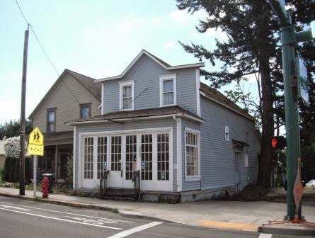
Christ Church Episcopal Parish, Lake Oswego's episcopal church. The building was originally constructed in 1950, with a major addition on the south side of the building in 2001. It is the second largest Episcopal congregation in Oregon, behind only Trinity Cathedral. The upper parking lot is a designated Trimet park and ride facility, and is never full except on Sunday mornings. It's a good place to park if you are arriving by auto.


The church is located at the corner of Tenth Avenue and Chandler Road. Cross Tenth, going eastward, and then proceed right on the sidewalk along Tenth. across from the church. Next to the sidewalk is this elaborate landscaped "green streets" storm drainage facility, built by Lake Oswego a few years ago. Many of these landscaped drainage depressions are popping up around the Portland metro area, as communities work to prevent untreated storm water runoff from polluting lakes and rivers.

Continuing on Tenth Avenue, after two blocks you will reach a triangular intersection with a center landscaped area. Turn left, onto Berwick Road. If you take this walk during 2014, you will see this political sign in several front yards along the route. It refers to a local controversy about redevelopment of the Wizer's market site in downtown Lake Oswego on "A" Avenue. Without getting into the merits of the actual argument, perhaps all can agree that the angry "highrise" on the sign looks more like an angry domino.

Continue down the hill on Berwick as it winds to the right. While this street, and most of the streets on this walk, have no sidewalks, the roads are lightly traveled with slow-moving vehicles, and an alert pedestrian should have no trouble staying safe. At the bottom of the hill you will get to this railroad crossing. Continue over the crossing and stay on the road that eventually turns to the right, which is Northshore Road.


Along Northshore you will get glimpses of Oswego Lake. I say "glimpses," because the lake itself is a private water body, open only to adjacent property owners and other nearby property owners that have a legal right to access the water body. The property status of the lake is currently being litigated by local residents claiming that the lake is actually a public water body, but the case will most likely take several more years to be resolved through the Oregon court system. For most of this stretch of roadway views of the lake are blocked by mansions such as this one.


Eventually you will get to a break in the mansions, and the lake will be visible on the left through the chain link fence guarding the Forest Hills lake easement. This is an authorized access point, one of several around the lake, for property owners without direct access, but with access rights deeded to the properties they own in the vicinity. These easement areas vary in size from small mini-parks such as this one to others with just a small dock and three or four boat slips. What's most interesting about this easement is what's next door to the right - a huge mansion built in 2007 on the site of an old private boat club. The tale involves placing fill into the lake, illegal cutting of trees, and lots of local controversy. Unfortunately you, as a member of the unwashed public, can't get a good look at what this monstrous mansion looks like, because it reveals itself in its full glory only from the inside of the Forest Hills lake easement or from the vantage point of a boat on the water.

Continue on Northshore Road until you get to Mulligan Lane, then take a right Once again you will cross the railroad tracks. These tracks now belong to the Union Pacific railroad, but were originally part of the Southern Pacific Railroad system (purchased by Union Pacific in the 1990's). Branching out from the old Southern Pacific west coast mainline in Milwaukie, this route crosses the Willamette on a bridge also in Lake Oswego and then continues west to serve local lines in Washington and Yamhill Counties. Several freight trains a day use the tracks. A proposal to put new high speed passenger routes on these tracks sparked some local consternation a few years ago, but the high speed rail planners are apparently now looking elsewhere.

Traverse the entire short length of Mulligan Lane to Iron Mountain Road, carefully cross the street to the "pathway" (really just a striped lane on the roadway) and then quickly turn right up Fairway Drive. On your left are large mansions. On your right is the Oswego Lake Country Club. This private and exclusive club, whose main feature is a full 18-hole golf course, was first established in 1924. First you will pass the back side of the main clubhouse, and then you will be along part of the golf course. While the beautiful manicured grounds might be inviting for a walking detour, I would recommend against it - first, you would be trespassing on private property, and second you might get injured by a flying golf ball.

Continue on Fairway Drive to the end of the street, where you will see a very large mansion directly ahead. But to the right is the trailhead for the Iron Mountain trail.


Start up the trail. The first portion of the trail also serves as a driveway for this cottage. It appears to be some sort of caretaker cottage for the park. Pass it and continue up the trail. The route you are following was a railway in the late 19th century, surrounded by a clear-cut hillside. It's quite a contrast from today's scenery.

The trail continues up a gentle slope, through the trees providing ample shade. When you reach a trail junction continue straight ahead rather than turning left and heading down the hill. Remember this spot - you will be returning to this location from the other direction later in the walk.


Continuing up the Iron Mountain trail, you will eventually reach a resting spot and interpretive display on the site of the Prosser Iron Mine. The railway ended at this location, and the now almost pristine hillside you are on was the site of a warren of mine shafts and associated activity. The mine shafts themselves have been sealed up and are inaccessible. Continuing beyond the mine site, you will come to another stopping point with benches. It is meant to be a scenic overlook, but all the trees on the hillside pretty much block out any views of Oswego Lake. This deck was originally built by a group of boy scouts as part of an eagle scout project, but was later modified by the City of Lake Oswego. Continuing on the trail, you will soon reach its end, on Glen Eagles Road. At the roadway, turn left.

You are now in Lake Oswego's Uplands neighborhood, characterized originally by mid-sized houses on large lots, but the more recently some of those houses have been the subject of extensive house enlargements and "tear-downs" in favor of new luxury dwellings. The neighborhood is now a sometimes uncomfortable mixture of the modest and the extravagant in terms of single-family residential development. You will see this contrast as you walk down Glen Eagles. At Wembley Park Road turn left, and stay on the left side of the street, which has a walking path.


Wembley Park tees into Twin Fir Road - turn left here. You will be only a short distance on this roadway, but it has a curve and not much of a shoulder, so be careful. At Edgemont Road turn left. This is a quiet dead-end street continuing the juxtaposition between older modest homes and newer more substantial dwellings.


At the end of Edgemont a trail leaves the roadway on the right - this is the route you will take. The trail is fairly steep and narrow with a few switchbacks as it heads down a hill, so watch your step. You are now back in the Iron Mountain open space area, with tall trees shading the pathway.


Eventually you will cross a drainageway on a wooden bridge. On the other side the trail forks - it doesn't matter which way you take, because after a few hundred feet the trails meet up again.


As you continue on the trail, to your right down the hill and through the trees you will see the Lake Oswego Hunt Club, a large equestrian facility with stables, pastures, and riding rings. The horses occasionally are ridden onto the trails of the Iron Mountain open space area, so keep your eye on the trail for the occasional horsepie. The Lake Oswego Hunt Club has been a civic institution since the 1920's, and is the only such facility remaining in the area. Since the club owns the property, and interest in equestrian activities remains high, this facility will be staying here for the foreseeable future, not to succumb to urban development as other similar facilities in the Portland area have.

Continuing on the trail, you will come to another nice bench allowing a rest while traversing back up the hill. Eventually you will reach the trail fork we talked about earlier, and you will continue on the portion of the trail you already traversed back to Fairway Road, past the caretaker's cottage. Continue down Fairway Road with the golf course now to your left and the mansions to your right.


At Iron Mountain Road turn left and stay on the left side of the street, where the pathway is located. After a few hundred feet, when you reach the entrance driveway to the Oswego Lake Country Club on your left, carefully cross Iron Mountain and proceed to the right on Pine Valley Road. Stay on Pine Valley as it winds to the left, past intersections with Westward Ho Road and Troon Road. Eventually the road loops back to Iron Mountain Road.

Once again, carefully cross Iron Mountain to the pathway on the left side of the road (actually just a striped bit of pavement) and head to the right. You will eventually reach a three-way intersection where Iron Mountain actually goes to the left and the road going straight ahead changes to Chandler. Stay right and take Chandler back to your starting point at Christ Church.

About Me

Blogs about biking and walking in the Pacific Northwest