Saturday, January 18, 2014

Multnomah Village and Gabriel Park - SW Portland

MULTNOMAH VILLAGE AND GABRIEL PARK - SW Portland

This 2.3 mile walk is a loop beginning at Gabriel Park, home to all sorts of recreational activities, and through Multnomah Village, Southwest Portland's most "Portland" neighborhood. The walk doesn't have any big hills, but there is quite a bit of up and down. It would be a great trip for families with children.


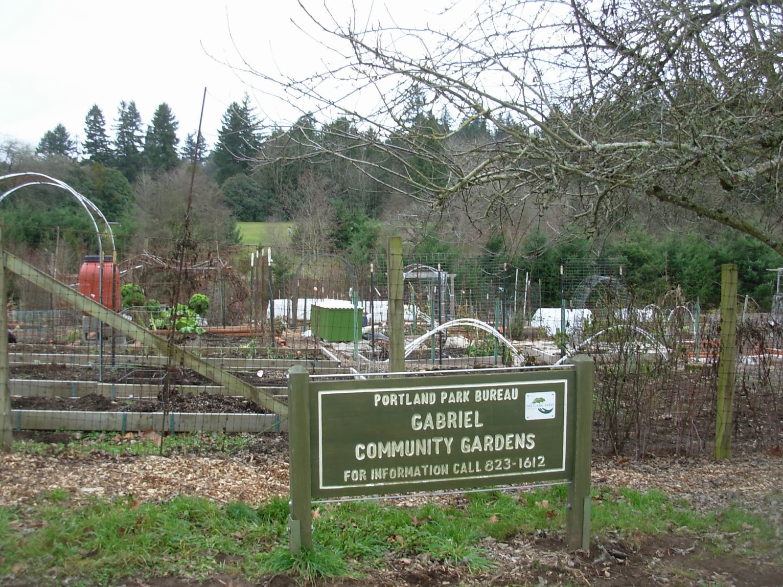
This loop walk begins at the parking lot near the Skate Park, one of the most heavily used parts of the 90-acre Gabriel Park, established in 1950. Before heading off along the trail, take a moment  to watch the skateboarders in action!  While skateboard parks were considered controversial in the past, because neighbors thought they attracted the "wrong" kind of people, they have become common park amenities in recent years.

From the parking lot, look to your right, or south, and take the pathway the goes between the two lower tennis courts leaving the parking lot at the accessible parking spaces, and parallel to SW 45th Street. You'll be walking in the opposite direction of the skate park. Beyond the tennis court to the right is the summer off-leash dog area of the park.


You will leave the tennis court area and head into the woods, along a pretty little trail. Whenever it forks, keep to the right. You will eventually reach a nice meadow. Keep walking up the meadow, until you reach a fork in the trail. To the right the trail goes up to Canby Street, but take a left instead.


You will soon be walking past the winter off-leash dog romp area, and then you will come to an untidy, but fertile-looking community garden. This is another great use of park land that is possible in large facility like Gabriel Park. During the growing season you'll see lots of healthy looking garden plots.


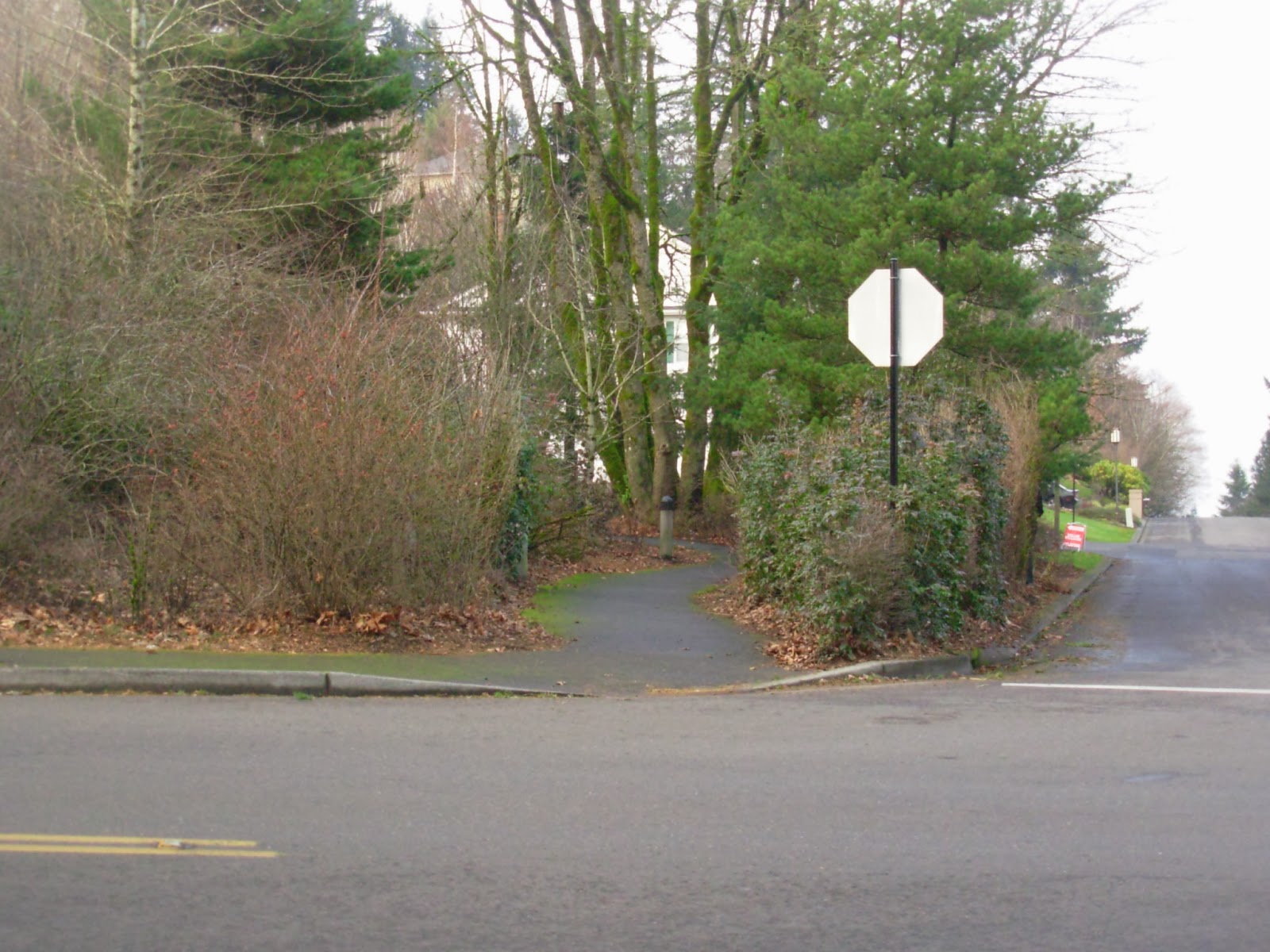
Continue up the pathway until you exit the park onto Canby Street, which runs parallel to the edge of the park. Although there is no sidewalk on this street, an unfortunate situation common throughout southwest Portland, there is very little traffic, and the straight route has no blind curves or corners. At 36th Street, you will see an off-street pathway to the left, with a "SW Trails" sign on it. SW Trails are a great alternative resource for walks throughout southwest Portland - the group sells a trails map, and the city has an online pedestrian map of southwest Portland with all of the trails indicated on it.

Continue south on 36th Street, and after Troy Street you will have sidewalks to walk on. Go one block and turn left on Capitol Highway. You are now in Multnomah Village.

Multnomah Village is a charming little neighborhood center, the closest thing to areas like SE Hawthorne, Hollywood, Sellwood, or NW 23rd that you will find in southwest Portland. The neighborhood was established around 1910, when the Oregon Electric Railway built a depot along its line through the village. Where are the rails, you ask? As you walk down 36th Avenue toward Capitol Highway, look one block further south, and you will see Multnomah Boulevard, a straight, flat street that runs perpendicular to 36th and generally east-west through southwest Portland. Once you get to Capitol Highway, if you look to the right you will see an old bridge crossing over Multnomah Boulevard. The reason this bridge was built? - the route of Multnomah Boulevard used to be the route of the Oregon Electric Railway, running from Portland to Eugene. It came up from downtown Portland along the route that is now occupied by Interstate 5, and then followed what is now Multnomah Boulevard into Tigard past what is now the Washington Square shopping center. This portion of the railway was abandoned around 1940.

The village has a couple of coffee shops if you want to stop for something here. Village Coffee is located on the left (north) side of the street at 7781 Capitol Highway, between 34th and 35th. And of course there's also a Starbucks, at 7737 Capitol Highway, at the corner of Capitol and 34th. There are also several restaurants along the street - look them up on Yelp for information. Annie Blooms bookstore, one of Portland's most notable local bookstores that doesn't start with a "P," is located at 7834 Capitol Highway, on the right (south) side of the street between 35th and 36th.  Also, there are quite a few gift and other knick-knack shops for perusal. For those who want a more fortified liquid refreshment, the Lucky Labrador Brew Pub is located on the left (north) side of Capitol Highway at its intersection with 32nd. Your dog is welcome inside if it has come along for the walk.

Take a left on 32nd Street. Sidewalks are intermittent, but there isn't much traffic on this street. After two blocks, take a left on Nevada Court, which, believe it or not, is a public street in the City of Portland! There are a lot of streets in Southwest Portland that are as decrepit as this one - I would hate to have to drive it every day, but it's fine to walk on, because there's so little traffic. Follow Nevada Court for several blocks - cross carefully at 35th Street, which has some traffic - until you get back to Gabriel Park.


At the corner of Nevada Court and 37th Street, you will reach the edge of the park. Turn north (right) on 37th for a block and then enter the park. Follow the trail to the southwest, which will lead you back to your starting point at the Gabriel Skate Park.


Thursday, January 2, 2014

Lake Oswego - Up to Mt. Sylvania and back - Version 2.0

THERE'S MORE THAN ONE WAY TO CLIMB UP TO LAKE OSWEGO'S ONLY (EXTINCT) VOLCANO!

This alternative route is also an almost 4-mile loop from Lake Oswego's Westlake Park to the top of the Mount Sylvania and back, a 638-foot elevation gain. 

The first half of the walk, like version 1.0, winds through the Mountain Park community. Soon after the community started it received a visit and blessing from none other than Oregon's legendary governor Tom McCall, who lauded Carl Halvorson and his development team for their vision. Mountain Park's 8,500 residents are the beneficiaries of Halvorson's design, and you are too as you walk on the Mountain Park trails and under its busy roadways.

But the other half of this walk takes you down through the Portland Community College Sylvania Campus, also developed in the late 1960's, and through additional wooded areas and some nearby neighborhoods.


Start this walk at Westlake Park, cross Melrose Street, and head up Peters Street. You'll be passing both new large attached townhomes and new large detached single-family homes. At Auburn Lane, turn right.


Once on Auburn Lane, make a quick left, and you will see on the right side of the street a trail heading up the hill. Take it. The large embankment on your right is actually the side of a buried underground water storage facility, courtesy of the City of Lake Oswego, with a nice grassy play area on top of it.


This trail tees into a Mountain Park Homeowners Association pathway. Take the route to the left - on your right are the backs of homes in Mountain Park, while on your left are the backs of homes not in Mountain Park, built in the 1980's. Eventually the houses on the left are replaced by a nice forested area.


Eventually you will get to this bridge. At the fork in the trail beyond the bridge, head to the right. On your left you will see an odd sight - what looks like a small industrial yard in the forest. In fact it's the maintenance yard and RV storage yard for the Mountain Park Homeowners Association.


Follow this trail to Bernini Street (you are once again in Mountain Park's "artist colony"!) Cross the street, and continue up the trail to one of the signature street tunnels throughout the Mountain Park trail system. This one seems particularly superfluous, consisting of twin tunnels taking the trail underneath Jefferson Parkway. They don't have any other purpose, such as conveyance of flood waters, that is apparent.


Once through the tunnel, you will be heading up a steep patch of trail, through the woods of Mountain Park, with a condo development to the right and some apartments to the left. The apartments are "notable" for being the site of the first murder in Lake Oswego, about 10 years ago, that had occurred since 1980. Since then they have been renamed, repainted, and generally upgraded. At the top of this trail, you will come to a paved trail paralleling Kerr Parkway. Take a left and then go through yet another tunnel under Kerr. 


Once through the tunnel, take the path up to the level of Kerr Parkway. You will have to go along a short stretch of the roadway without a sidewalk, but there is a wide shoulder. On your right is a large apartment complex. Suddenly, a short sidewalk begins, ending at a stairway going up to the right. Take it.


After a short distance along this concrete walkway, take the stairway to the left. You will now be walking through a dead-end street with townhomes on both sides.


At the entrance to the townhome development, take a left and then another quick left onto McNary Parkway.


Now you have a bit of overlap with the first Mt. Sylvania hike, as you cross McNary onto Hidalgo, but follow a nice little trail in McNary Park, built on top of a Lake Oswego water reservoir. Leave the park trail and head up Juarez, then turn left onto Garibaldi. Instead of taking the short, steep route up to the summit, follow Garibaldi on its winding route up the hill, enjoying the monumental architecture of some of the huge houses, especially on the uphill side of the street. You will notice a couple of very steep vacant lots, and you can appreciate the amount of geological analysis that (hopefully) went into the design and construction of these houses! Eventually on your left you will see a little calf-burner of a steep walk from Garibaldi up to Nansen Summit Road, marked by a Mountain Park trail sign.


Once you reach the top, go up to the summit and enjoy the views. This picture, taken on a cloudy day, doesn't do the views justice. The best views are of Washington County to the west, since a bunch of darn big trees get in the way (at least partially) in the other directions!


There are some nice-looking houses at the top of Mt. Sylvania, but my favorite is this one, on your left as you head down Nansen Summit, at the corner of Nansen and Bolivar. It might not be to everyone's taste (I know of one critic who loathes the turquoise rockwork mixed in on the facade), but I think it's a great-looking house.


Walk down Nansen Summit to Becket, and take a right. Then take a left on Hidalgo, cross 49th Street at the signal light, and you are now on the Portland Community College campus. Head into the campus, and follow the circumferential road to the left. Our official route will take you around the campus parking lot and buildings, but you can take a detour by going straight toward the buildings and looking around.

Portland Community College has three main campuses, of which this one, the Sylvania Campus, is the first and largest. It serves 26,000 students, and was opened in 1968. As you look down upon the campus from the 49th Street entrance, the first thing you will see is a giant parking lot - most of the students commute to campus by auto, rather than by Trimet bus or via bicycle. Beyond that is a row of newer buildings, including the campus library, that were built in the 1980's and 1990's. And behind the newer buildings are the original campus buildings. These were designed in the institutional style now known as "brutalist;" concrete structures with exposed beams. The brutalist style of architecture has not aged well, and most institutional architecture since this period of construction has been a reaction against the style.

One additional note - if you need to make a bathroom stop, the campus will provide, unless you are taking this hike during a period when the campus is closed (late nights, holidays, weekend evenings, evenings and weekends during class breaks).

As you walk along the perimeter road, look for this scene - a tarp-covered concrete silo of some sort on the left side of the road. Our trail down the hill begins at this structure. Follow the trail down hill, past the PCC athletic field (in the Winter of 2014 there is a construction site with trailers that you will pass by).


Keep on following the trail down the hill, and continue through the forest. Below the athletic field, where the trail forks, keep to the left. You will then reach the end of Haines Street. There is no sidewalk on these streets, but there is very little traffic, until you get to Lesser Road, site of a 4-way stop.


At the 4-way stop, cross the street and go for 
a brief walk along Lesser Road to the left. But be sure to stay straight and go onto 62nd Avenue. Do not stay on Lesser Road; this heavily traveled street has no sidewalks or shoulders along most of its length, and with cars speeding a 35 mph, it is a death trap for pedestrians. While 62nd Avenue also has no sidewalk, it also has much less traffic, moving at 25 mph (hopefully).


Follow 62nd Avenue as it goes down the hill. You are going through a neighborhood that was developed in the 1950's and 1960's with houses that were called "tract" houses at the time, and now with the patina of age are often called "mid-century modern." In the lower half of the street are some of the ubiquitous split-level entry homes that proliferated in suburban neighborhoods at the time. Go to the end of the road, and you will see a trail entrance into a Southwood Park.

Follow the trail and go through the park. The city park has a sign indicating prohibited items, including firearms and paint guns. I'm sure there's an interesting story involving wayward Lake Oswego youthful exuberance behind the prohibition of the latter!


The rest of the walk will take you through the Westlake neighborhood, developed in the late 1980's and 1990's, with the predominant architectural styles switching from the "mid-century modern" on 62nd Avenue to various colonial pastiches, with a heavy dose of English tudor. Suncreek Drive, the road you are on, will end at Fosberg Road, but continue across the street with a slight veer to the right and follow Melrose Street back to Westlake Park and your starting point.

About Me

Blogs about biking and walking in the Pacific Northwest