Tuesday, June 10, 2014

Eugene - University of Oregon

EUGENE - THE UNIVERSITY OF OREGON

While Portland is much larger, Eugene is the second largest metropolitan area in the state. And it is the home of the University of Oregon, the state's flagship university (although half the state, partisans of Oregon State University in Corvallis, might beg to differ). This walk will explore the university and some surrounding neighborhoods on a 3-mile journey, along a relatively flat route.


This walk starts at the intersection of Kincaid Street and East 11th Avenue, immediately south of Franklin Blvd. (Old U.S. 99). There is a parking area on the north side of East 11th. If you do this walk on a weekend there is generally available parking in the lot and the metered street spaces nearby don't charge on weekends - otherwise you will have to feed a meter for a street parking space in the vicinity.


Immediately to the south of the parking lot, on East 11th Avenue, is a bus rapid transit station for Eugene's EmX system. This station serves the Franklin Avenue line running from downtown Eugene east to the City of Springfield. A second line runs north-south in Springfield. An extension of the line from downtown to West Eugene has sparked much controversy. In general, bus rapid transit relies on the use of exclusive bus lanes to provide much speedier service, akin to speeds available in a grade-separated light rail system, but at much less cost (although still too expensive according to some).


From the EmX station turn right and walk along East 11th Street. In the next block the university campus begins - but it is not the University of Oregon, but rather Northwest Christian University. The school was founded in 1895 as a divinity school, with students taking religion classes on campus and walking across the street to the University of Oregon for other coursework. When this arrangement was discontinued by the larger university in 1995, Northwest Christian transitioned into a full-service liberal arts school. It currently has about 650 undergraduate students. The "Beacons" play their sports in the Cascade Collegiate Conference against a variety of small religious and public colleges such as Evergreen State, Eastern Oregon, Concordia and Warner Pacific. While the school plays men's basketball, it is doubtful that the squad will ever face off against its much larger neighbor - and there is no football team. The three-story Martha Goodrich Administration Building, shown in this photo, was constructed in 1908 of volcanic stone.

At Alder Street, turn right. Go one block, then turn right onto Franklin Blvd. After one block, turn right again onto Hilyard Street. On your right is the Gamma Phi Beta sorority house. This Tudor-style structure was built in 1926. Gamma Phi Beta was the first sorority at the University of Oregon.


Across the street on the left is the Chi Psi fraternity house, built in 1935, and also a Tudor style structure. The building was designed by noted Lake Oswego architect Richard Sundeleaf. The water feature along the side of the fraternity is a side channel of the Willamette River. The main channel of the river is less than 1/2 mile to the north.


Also on the left side of the street, as you near 12th Avenue, is the Alpha Phi sorority house. This house was built in 1925, and is described as a "Norman farmhouse" style in its nomination papers to the National Register of Historic Places.


Continue south on Hilyard Street. After crossing 12th Avenue you will be passing between two buildings of Sacred Heart Hospital. The hospital engendered some local controversy a few years back by threatening to relocate to a site in Springfield to the east, but finally ended up keeping this site as well as the new hospital facility in Springfield. Walk underneath the pedestrian skyway connecting the two hospital blocks.


Turn right on 13th Avenue, into the University commercial district. Along with many restaurants and the current location of the university bookstore, this building on the right side of the street represents a lot of new student housing developments that have sprouted up around the university campus to house the growing number of students in attendance.


Continue on 13th Avenue to the next block, which consists mainly of businesses catering to students, including the University Bookstore. Note the reservation of significant street pavement for bike lanes in this area. While Portland has become more bike friendly and known around the nation for its bicycle culture, Eugene has been accommodating bicyclists on its streets for much longer.


At the intersection of 13th Avenue and Kincaid Street you will see the formal entrance to the university campus. Continue straight ahead.


On the right is Condon Hall, home to the Department of Geography. And on the left is the Lillis Business Complex. The 2003 structure in the middle of the plaza is flanked by two older buildings constructed in 1917 and 1922. The building has one of the largest solar installations in the western U.S., and was built to demonstrate principles of sustainability.


Turn right at the open area immediately opposite the Lillis Business Complex plaza. Chapman Hall, home of the university's honors college, is on your left. After passing by Chapman Hall, turn left and you will pass by the Jordan Schnitzer Museum of Art on your right. This museum was constructed in 1937, and its collection is best known for its East Asian art. Continue past the Museum of Art. When the pathway ends at a stub roadway, follow it straight ahead. The roadway ends at University Street, and directly across from you will be the Erb Student Center.

Turn right on University Street. Past 15th Street, on the left, is McArthur Court, home of the Oregon Ducks basketball team from 1926 until the Matthew Knight Arena opened in 2011. Although the facilities were antique, it's a shame that this 9,000 seat arena, popularly known as "the Pit," is no longer in use. There's too much basketball history to easily summarize in this small space, so wiki McArthur Court or look here for more information. A book entitled "Mac Court Memories" was published in 2010, but is apparently out of print.


On the right side of University Street is the Eugene Pioneer Cemetery, established in 1872, and on the National Register of Historic Places. The cemetery is 16 acres in size and contains several thousand burial plots.

Continue south on University Street to 18th Avenue, which is the southern boundary of the University of Oregon campus. Across 18th Avenue to the left are the Prefontaine Apartments, opened in 2013. They represent a new type of student housing, essentially an off-campus privately-run student dorm. The 20 units are 3 or 4 bedrooms, housing one or two students per room, with each unit sharing a living area and kitchen. Several of these types of buildings have been built in Eugene and Corvallis over the past few years, and undoubtedly in other campus towns around the U.S.

Turn left on 18th Avenue and walk two blocks to Onyx Street, and then turn right. A couple houses down on the right is Onyx House, another kind of student housing. Onyx House is operated by the Eugene Faith Center, a large nondenominational church elsewhere in the city. It provides housing for Christian students where they "can accomplish their academic and career goals while being involved in campus ministry."


Continue on Onyx to 19th Avenue, and then turn left. On the next block to the right is Studies at 19th, another new student housing block. The units are 2 to 4 bedrooms, and it is unclear whether they are rented by the room or by the apartment to a group of students that organize themselves.


Continue another block to Agate Street. At the corner on the right is McMenamins East 19th Street CafĂ©. Outside the front door is a peace pole, reading "May Peace Prevail on Earth" in four different languages including what has been described as "animal language." The three McMenamins taverns in Eugene are the southernmost outposts of the beer empire.


Turn left on Agate Street and proceed north. After crossing 18th Avenue you will be back on campus. To the left is Hayward Field, home to the University of Oregon's vaunted track and field program. Built in 1919, until 1967 this was also the university football stadium.


On this lamppost along Agate Street is a banner celebrating the university's most famous track and field athlete, Steve Prefontaine (1951-1975). The Pre Classic is held at Hayward Field each spring in his honor. Prefontaine was born in Coos Bay, finished 4th in the 5000 meter run at the 1972 Munich Olympics, and at the time of his death held several world records as he prepared for the 1976 Montreal Olympics. He died after hitting a tree with his sports car on a windy street in the hills above Eugene. Two biographical films of his life were made within a year of each other, Prefontaine (1997) starring Jared Leto, and Without Limits (1998) starring Billy Crudup. Both are pretty good movies.


Across the street from Hayward Field on the right is the School of Law, one of three law schools in Oregon. The main building shown here is the Knight Center, named for its principal donor, Nike Chairman and university alumnus Phil Knight.
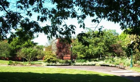

At the corner of Agate St and 15th Avenue, the northern end of Hayward Field, cross 15th and head into the park area on the right side of the street. Go toward the northeast corner of the park area. The buildings at the north end of the park are the Bean Complex, originally built in 1964 and generally considered the most decrepit of the current university residential dorms.


At the northeast corner of the park continue and note the contrast with the Bean Complex. Directly ahead is the back entrance of Matthew Knight Arena, home to the Oregon Ducks men's and women's basketball teams since 2011. The complex is named for Phil Knight's son, who died at age 34 in a scuba accident. Very nice for a back entrance, don't you think?


Continue to the left toward 13th Avenue and, beyond, Franklin Avenue (old Highway 99). Turn right and behold the front entrance of the Matthew Knight Arena. The most unique aspect of the building must be seen from the inside - the basketball court's floor.


After you have seen the front of the arena, turn around and proceed west on 13th Avenue back into the campus. On your right is the John Jaqua Center, a futuristic building that houses academic services for Oregon's NCAA athletes. Built in 2010, the building was funded by a grant from Phil Knight and honors a long time university supporter as its namesake. The contrast with the decrepit Bean Hall residential complex across 13th Avenue on the left is striking.


Continue on 13th Avenue back into the heart of the campus. Among the academic buildings on both sides of the street is the Lewis Integrative Science Building, on the right, opened in 2012.


Continue on 13th Avenue. To your left is the Erb Student Union again. At Friendly Hall, follow the pathway through the open treed area to the right.


Continue across the open area and veer diagonally to the left across it. On the other side, to the left, is Deady Hall, the first and oldest building on campus. It is named for Matthew Deady, Oregon's first federal judge, who ironically opposed authorizing a state university at Oregon's constitutional convention of 1857 (the state was admitted to the Union in 1859). When it opened the university's enrollment was 177, but that number included 98 high school students since Eugene did not yet have a high school.  There were five faculty. The building now houses the mathematics department. Deady's architectural style is Italianate.


Continue beyond Deady, and the next building on the left is Villard Hall, the second building on campus, completed in 1886. It's style is described as Second Empire, named for the French Empire of Napoleon III (nephew of the original Napoleon who created the First Empire), ruler of France from 1851 to 1870. The building is named for Henry Villard, railroad magnate and owner of the Northern Pacific Railroad, who donated the money for the building. The building now houses the Theater Arts Department.


At the corner of the building, turn left back to your starting point, past the EmX bus rapid transit station.

Saturday, May 31, 2014

Tryon Creek, Lewis & Clark and Dunthorpe - SW Portland

TRYON CREEK, LEWIS & CLARK AND DUNTHORPE

Tryon Creek is a great spot to take a walk through nature while still in the City of Portland - it's the less-known southern sister to Portland's Forest Park. And next to Tryon Creek Park is the exclusive Dunthorpe neighborhood, home to Portland's richest residents (actually most of them live in an unincorporated pocket of Multnomah County) and also home to some pricey residential architecture. This walk combines a jaunt through Tryon Creek Park and Dunthorpe, and also takes you through the Lewis and Clark College and Law School campuses. It's 4.6 miles, and includes some moderate up and down topography.


This walk could start at many places along the route, but we'll start at Lewis and Clark Law School. If you are taking this walk on a weekend you can park in most of the law school's parking lot. Otherwise, park on Terwilliger Place to the east across Terwilliger Blvd. - unless you are a law student, in which case you will be ticketed by the Lewis and Clark security patrol!

Lewis and Clark Law School began as Northwestern College of Law in the 19th century in a downtown Portland building. The school moved to its current campus in the 1960's when it was acquired by Lewis and Clark College, and it was accredited by the American Bar Association around that time. The school has a beautiful campus nestled adjacent to Tryon Creek State Park and its forest.  While the buildings on the north and east end are the original campus, the library and classroom building to the west was completed at the turn of the century. The law school is now solidly in the middle of the U.S. News and World Report law school rankings, and has one of the best environmental law programs in the nation.

Go to the east end of the campus, along Terwilliger Blvd. As you head to the west, behind the law school administration building, you will see this fork in the trail. Take the trail to the left, which heads to the south away from the law school.


This paved trail through Tryon Creek Park is also a designated bikeway, the only trail through the park open to bicycles. While paralleling Terwilliger, very little noise from the roadway will interfere with enjoyment of these forested surroundings.


You will eventually come to a driveway crossing, which is an access road for park maintenance vehicles from Terwilliger. Go straight here. Next you will cross the main access driveway for Tryon Creek park visitors. After the driveway, turn left to follow the bike trail along Terwilliger.


After some more meandering through the forest, the bike trail meets up with Terwilliger, although it is still separated from the roadway by a curb. Soon you will see Iron Mountain Blvd. off to the left of Terwilliger. Iron Mountain Blvd. is also a major roadway in Lake Oswego to the south, and at one point the two sections of this road were destined to meet as the land in between was developed with housing. However, the State of Oregon fortunately intervened and purchased the land that became Tryon Creek State Park. Walking through the steep terrain and many waterways of this park, it's hard to imagine what it would look like today if developed with housing.


Looking across Terwilliger, be sure to take Iron Mountain Blvd., which is the roadway to the right in this picture and not the paved roadway to the left. The roadway to the left is a private drive, not a public right of way, and provides a "back exit" for a fancy residential neighborhood up the slope.


Iron Mountain Blvd. has no sidewalks, but traffic on the roadway is sparse and slow-moving. The homes along the street are a mixture of different styles and ages. This particular home on the left side of the street is one of the newer ones, with an unusual architectural style.


Farther down the street, on the right, is this older colonial style home, on a huge lot with a stately front entrance way.


Iron Mountain Blvd. tees into Greenwood Road. Go left on Greenwood. On the left side of the street is this gated entrance to a grand mansion beyond. The plaque next to the gate indicates that the property is owned by Lewis and Clark College, but its current use is by the school is not readily apparent.


Soon after the mansion turn right onto Tryon Hill Road. Continue on this narrow lane until you get to a gate on the left, which prohibits through vehicle travel, but has a pedestrian bypass. Continue past the gate, and continue up the hill on the narrow lane.


When the lane levels out, you will find yourself in the middle of a private residential community. Turn right and continue past the green open space.


This is Corbett Hill Road. Continue past the grassy common area and go to the end of the road, which is the main vehicular entrance to this private community. Turn left on Military Road. Military is one of two through streets from Highway 43 to the Lewis and Clark College area so it has more traffic, and it also has no sidewalks. So walk carefully - after a few hundred feet there will be a safe area to walk on the right side of the street. But don't worry - "more traffic" still isn't very much in this neighborhood, and the curves in the road mean the cars are most likely going at slow speeds.

Continue on Military Road until Aventine Circus, and then turn right. Continue down this narrow little road.


The pavement ends, but Aventine Circus continues straight ahead. It's no problem to walk this, but drivers need four-wheel drive to pass this rutted stretch of roadway. At the end of Aventine Circus turn left onto Palatine Hill Road, which is the second of the two through routes up the hill in Dunthorpe. But once again, there really isn't much traffic, and there is room to the side of the road to walk despite the lack of sidewalks.


Continue on Palatine Hill Road until Esquiline Circus, and make a right turn. Esquiline Circus is another narrow road with light traffic. Unlike Aventine Circus it is paved along its whole route, but with one hitch...


The pavement narrows to a three-foot width at this point! Blink and you might miss this walkway, which connects two segments of Esquiline Circus. But don't be afraid to take the path - it is located in a public street right of way, so you have as much right to use it as any of the residents along this street. Once to the other side, continue to Comus St., and then turn left.


Comus Street meets up with Palatine Hill Road, and to the right is the main campus of Lewis and Clark College. Take a right at the first driveway on Palatine Hill Road, and go down the hill between the brand new dorms in Holmes Hall to the left and the facilities building to the right. Turn right at the driveway beyond the facilities building and then turn to the left in the parking area a little farther down.

As you go through the parking area, you will see straight ahead a bridge that goes over a ravine. Go over the bridge.

Originally Albany College (and located in Albany, Oregon), the school moved its entire operation to Portland in 1938, and was gifted with this campus site in 1942, when it changed its name to Lewis and Clark.


The site of the college was originally the 63-acre Frank Estate, and this beautiful home straight ahead was the main house, with 35 rooms. The estate was named Fir Acres.


Continue to the right down the pathway - the estate house will be on your left. You will pass this statue of Sacagawea and her infant son Jean Baptiste. The college website devotes this page to the statue, placed on this spot in 2004.


Continue on the path, and off to the right and down the hill is the beautiful formal Frank Estate gardens, with a view to Mt. Hood on clear day. Take a short detour down the hill if you have the time and enjoy the flora.


Follow the trail and continue until you see the Pamplin Sports Center, which provides the campus with its indoor recreation facilities. The center was built in 1969 and includes the college's home basketball gym, seating over 2,000.


At the sports center turn left and follow the wide walking path. To the left up the hill is the Agnes Flanagan Chapel, home of campus spiritual activities, and described here. To the right is Griswold Stadium, with 3,700 seats, home to Lewis and Clark Pioneers football, soccer, and track. The school plays in the Division III Northwest Conference, where the football team is an also-ran usually trailing traditional small-college Oregon powerhouses at Linfield and Willamette Colleges.


Continue on the pathway until you reach Palatine Hill Road. Take a left, go a short distance, and then cross the street to the right and head down Riverside Street.


Continue on Riverside Street to Terwilliger Place and then turn right. Follow Terwilliger Place to Terwilliger Blvd, cross the street, and you will find yourself back at the Law School at the beginning of the walk.

About Me

Blogs about biking and walking in the Pacific Northwest