Monday, June 27, 2016

Oceanside

One of the most spectacular spots on the Oregon Coast, a coastline full of spectacular spots, is the small village of Oceanside, almost directly west of Tillamook. This small town is built for the most part on the side of a hill rising steeply from the Pacific and overlooking the Three Arch Rocks National Wildlife Preserve. This 2 mile walk will take you up and back down the steep hill on which the town is perched and then along the beach itself, including an interesting surprise at the end.


Start the walk at the Oceanside Beach State Recreation Site parking lot. Don't go down to the beach just yet - instead you will be going up this hillside of houses for some spectacular views back toward the ocean and the rocks. The Recreation Site is for day use only. The land was donated to the state by very public-minded local property owners.

Start up the hill on Maxwell Mountain Road. Where the road turns to the left it becomes a one-way street, for what will soon become an obvious reason. The warning sign pictured is also very good advice.

The road is narrow and unpaved, but fortunately traffic is very light and very slow. The views are spectacular. The rocks you see offshore are the Three Arch Rocks National Wildlife Refuge, established in 1907 as the first national wildlife refuge on the Pacific coast. The story of the establishment of the refuge can be found here.

As you continue up the hill you will also see some spectacular examples of hillside architecture, such as this house. All with great views, and hopefully all with solid geotechnical foundations!


The road makes a hairpin turn to the right above Maxwell Point - once past the turn take the road that goes more to the left, farther up the hill. On Maxwell Point is an abandoned (as of 2016) hotel. Until 1968 this spectacular spot was home to the Viewpoint Inn. It was replaced by the current buildings, once known as the House on the Hill and then the Clifftop Motel. It's unclear why the motel closed - there is an interesting court case involving a same-sex couple, artificial insemination, and parental rights, but the two were managers of the motel, not owners. It is hard to imagine failing in the motel business at this particular site.
Continuing up the hill on Maxwell Mountain Road the street remains narrow and unpaved, the sparse traffic is slow, the houses are precariously perched, and the views are fabulous.

Continue up and up. Eventually you will get to this viewpoint along the road, also the location where Maxwell Mountain Road makes another hairpin turn up the hill. You, however, will turn right onto Cedar Street and start heading down the hill along the roadway.

Cedar Street has plenty of trees along its sides as you head down the hill. At the intersection of Cedar and Chinook Streets is this unusual home, trying to take advantage of the view opportunities above the trees toward the ocean.


Continue straight, as the street you are on is now Chinook Avenue, continuing on a more gentle slope down the hill. On the right is the Oceanside Chapel, the only religious institution in town. The non-denominational congregation meets for worship on Saturday evenings. The chapel also serves as a designated emergency gathering place after the big earthquake and tsunami some day.

At Lilac Street turn right, and after one block turn left onto Sunset Avenue. Walk four blocks on Sunset Avenue to Cape Meares Loop, a major street. Turn right here and go one block to Pacific Avenue, where you will turn right. Pacific Avenue is the "main street" of Oceanside, with a post office, a few shops, and several restaurants.

Eventually you will get back to your starting point at the Oceanside Beach State Wayside, but don't finish this walk quite yet!. Go from the parking lot down to the beach and turn right. Bring along a flashlight if you can.

Oceanside beach is one of the most scenic on the Oregon Coast, and that is hearty praise! As you walk along the sand (your precise location will depend upon the tide) enjoy the views of the Three Arch Rocks and the bird life that is often nearby on the sands.


Ahead is Maxwell Point, and this tunnel entrance. There's a sign at the entrance warning of rock falls, but go ahead and peer in. You'll see light at the end of the tunnel - this is definitely no dead end! The Maxell Point tunnel was built in the early 20th century and is currently passable. But the floor of the tunnel is quite rocky in its middle, which is why you should have the flashlight along.


And this is the view from the tunnel's north portal. It is known as Lost Boy Beach, and if you want to extend your walk, continue north until you run out of beach near Cape Meares. And then head back through the tunnel, back along Oceanside Beach, to your starting point at the Wayside.

Friday, May 13, 2016

Salem Religious Institutions

Salem has a number of distinctive religious buildings in its central area. This 4.2 mile long walk will take you by a number of them, as you meander through central Salem. All but two of the buildings along the route are Christian in nature, the exceptions being a Buddhist temple and a Bahai worship place. The walk also traipses through Willamette University, the downtown commercial district, and the State Capitol. While long, the route is level.


The walk begins at the corner of 17th Street and Chemeketa Street NE. On the corner is the Chemeketa Street Evangelical Church building, which has been converted to a private residence. The church was originally built in 1894. While it is not individually on the National Register of Historic Places, the entire Court-Chemeketa neighborhood in this area is on the National Register. The original church vacated the building in 1929, and later it was used by Mennonites and then the LDS Church ("Mormons") until conversion to a private residence some time before 1987. The original Evangelical Church that inhabited the building was probably an ethnic German congregation, espousing the Calvinist strain of German Protestantism (in contrast to Lutherans).
Go south on 17th Street. In one block, at the corner of Court and 17th, is the Court Street Christian Church. While this building was constructed in 1949, the church has been located on this site since 1913, started as an east Salem "extension" of the First Christian Church in downtown Salem (visited later on this tour). Looking at the church's website, it appears to be non-denominational, professing no connection to any larger or national church organization. The church's theology states that the Bible is the only authority for its faith, but does not explicitly state that the Bible is inerrant.

Continue on 17th Street to its intersection with State Street. Turn left and go two blocks on State Street. At the corner of 18th and State is the State Street Church of God, which has only this sparse Facebook page for its online presence. More information about the building's history is available here. The church building was constructed a few years after 1900 for a predecessor of the Evangelical Lutheran Church, a "mainline" Protestant denomination (see discussion for St. Mark Lutheran Church later on this walk). After a stint as a Baptist church the present congregation arrived in 1976. It appears to be a non-denominational church, which means it has no affiliation with a larger group of churches.

At 19th Street turn right and go one block to Ferry Street. On the corner of 19th and Ferry is the Korean Church of Salem. The church has a Facebook page without much content. The Korean Church of Salem is a Presbyterian congregation. The building was originally constructed in 1926 by a Congregationalist congregation which closed its doors and sold the building to its current occupants in 2005.

Turn right on Ferry Street and then turn left onto 18th. Go two blocks on 18th to Mill Street, then turn right and go three blocks on Mill to 15th Street - carefully cross busy 17th Street. At the corner of 15th and Mill is the Mia Chung Buddhist Temple, located in this attractive red building. The temple does not have a website - in fact, it appears to have no internet presence of any kind.


Continue on Mill Street to its terminus at 12th Street. Use the pedestrian crosswalk to carefully cross traffic, and then head right on 12th Street. After you pass the parking lot on your left turn left into the Willamette University campus. Turn right between the first two buildings, and then left at the first opportunity between buildings. Continue to the large green area known as the Quad. Go around the Quad to the right and stop at the second building on the right. This is Waller Hall, the oldest building on campus (dating from 1867). Among other campus offices it is the home of Cone Chapel, the school's religious facility.

If you visit during weekdays you can go into the chapel itself. In its current form it was consecrated in 1989. It features a stately pipe organ in the front and a dozen large stained glass windows. While Willamette University was founded in 1842 by Methodist missionaries the school has long been unaffiliated with any religious institutions.


After leaving Waller Hall continue north toward the State Capitol. At State Street turn left and head down the street. At the intersection of State and Cottage Streets, to the left,  is a Baha'i Faith Center. The Baha'i Faith was founded in 19th century Iran, and asserts a synthesis of past prophets of many world religions into a new monotheistic religion of world peace and unity. There are about 5 million adherents worldwide. The largest number used to be in Iran, but the Islamic regime under Ayatollah Khomeini and his successors has worked to ruthlessly extirpate the faith from that county since 1980.

Continue straight ahead on State Street for another block to Church Street. The street may be named for this structure, the First Methodist Church of Salem on the corner of State and Church Streets, originally built in 1878. Its spire is taller than every other structure in the city other than the State Capitol.  The original spire had to be replaced in 1984, but the new spire is an identical match. The United Methodist Church has 7.2 million adherents in the U.S., making it the third largest national church (behind Roman Catholicism and the Southern Baptists). This "mainline" Protestant church has its origins in the preachings and teachings of legendary 18th century evangelist John Wesley.

Turn right onto Church Street and proceed two blocks to Chemeketa Street, where you will turn left. After three blocks on Chemeketa turn right onto Commercial Street. In the first block, on the left, is the Union Gospel Mission. Founded in 1953, it serves the homeless while trying to convert them to Christianity, or at least have them become receptive to Christian teachings. There are many such Christian homeless shelters and providers of services to the homeless throughout the U.S. - the largest of these is the Salvation Army.

After two blocks on Commercial Street turn right onto Marion Street. After one block, on the corner of Marion and Liberty Streets, is the Salem First Baptist Church. A short history of the church is found here - while the church has been on this site since 1868, the current building was constructed in 1951. First Baptist does not make any mention of a national affiliation on its website, but it appears to be part of the Conservative Baptist Association, a loose group of churches that split from the more "liberal" Northern Baptist Convention in the middle of the last century. The history of formations, splits, and unions of groups of Baptist churches in this nation is much too complicated for any explanation here. National Baptist church organizations are often very loosely organized, and the particular theology of individual Baptist churches in the same grouping may vary widely. The Baptist faith is differentiated from other versions of Christianity by belief that the act of baptism - committing oneself to the Christian faith by complete immersion in water, is only possible for consenting adults (as opposed to the practice of other Christians, most notably Roman Catholics, of baptizing infants).

Turn left onto Liberty Street and after one block turn right at Union Street. After two blocks on Union turn left onto Church Street and walk north. At 675 Church St. NE is this beautiful old federal-style home. It is the Endicott House, built in 1910. and now converted into offices.


Continue north on Church Street. You will soon reach this bridge in the road that crosses Mill Creek. This waterway, augmented by a diversion from the Santiam River, meanders around the central Salem area, occasionally flooding homes and other buildings along its banks.

Continue on Church Street to "D" Street, then turn right. After one block, at the corner of Cottage and "D",  is the Evergreen Presbyterian Church. This congregation is a member of the Presbyterian Church in America (PCA). The PCA split from the mainstream Presbyterian Church U.S.A. in the 1970's as a conservative reaction to the increasing liberalism of the national Presbyterian church, disagreeing with among other theological innovations the ordination of women. However the building, constructed in 1928 in a neo-Gothic style, was originally the Bethel Baptist Church, and has only been occupied by the current Presybterian congregation since 2008.
Turn right onto Cottage Street and go back south. After one long block you will reach Union Street - proceed another block to Marion Street. Between Union and Marion on your left is the Old Garfield School Building. Constructed in 1909, it served as an elementary school until 1973. It has now been repurposed as office space, and is on the National Register of Historic Places.

Opposite the Old Garfield School Building, on your right, is the Salem First Christian Church. The church is part of the Disciples of Christ national church. The church requires a belief in Jesus Christ as the Son of God, but encourages its individual churches and members to find their own way in Christianity and not follow any additional established doctrine. The church's national membership has declined steeply from 2 million in the 1950's to 650,000 today. Three Presidents, James Garfield, Lyndon Johnson, and Ronald Reagan, were Disciples of Christ at some point in their lives. This brick building that is home to the congregation was built in 1951, although the congregation was established in Salem way back in 1867.

Turn left onto Marion Street. On your right is the First Congregational United Church of Christ. The church's website describes itself as a "long established, theologically liberal, open and affirming, just peace congregation." The United Church of Christ is the most theologically and politically progressive of mainline Protestant churches in the United States, which is interesting, since Congregationalism has its roots in the austere Puritan churches of 17th century Massachusetts. The history of First Congregational in Salem goes back to 1852 - the current building was dedicated in 1941.

The next church is adjacent to the First Congregational Church, at the corner of Marion and Winter Streets, on your right - St. Mark Lutheran Church. This "American" Lutheran Church (with services in English instead of German) was formed in 1927, and originally used the "Old Presbyterian Church" building a couple of blocks away on Church Street. In 1958 the church dedicated this building and the old church, originally built in 1894, was demolished. St. Mark is a member of the Evangelical Lutheran Church of America (ELCA), which is a mainline Protestant denomination. This branch of Lutheranism is in "full communion" with the national Episcopal, Methodist, Reformed, Presbyterian, United Church of Christ, and Moravian Churches, which means that these churches welcome members of sister churches in services. including at communion, recognize ordained ministers of sister churches, and coordinate and worship together in other ways that are described well in this ELCA webpage.

Notably, "full communion" among American churches does not include the Roman Catholic Church in America. Which brings us to the next church building. At Winter Street turn right and go two blocks to Chemeketa -  on the right is St. Joseph Catholic Church. While a Roman Catholic church building has been present on this block since 1864 the current building was completed in 1957, apparently with some local controversy over the height of the bell tower. Behind the church building is St. Joseph's Elementary School.


On the opposite corner of Winter and Chemeketa, on the right, is First Presbyterian Church, built in 1928. Amazingly, this substantial church building was moved to this location. The church was originally at the northeast corner of Winter and Chemeketa Streets. In 1958 it was moved diagonally across the Chemeketa/Winter intersection to its current location, to make room for the State's Bureau of Labor and Industries building. First Presbyterian is a member of the Presbyterian Church USA, a mainline Protestant denomination. Presbyterianism has its roots in the Scottish Reformation of the 16th century, whose leader was John Knox, and is based upon rejection of the rule by bishops and their replacement as leaders by governing boards of lay elders, or presbyters.

Continue one block further on Winter and then turn left onto Court Street. Stay on the left side of the street as you pass the State Capitol on your right, and continue several blocks, past the 12th Street railroad tracks, to the corner of 14th and Court. On your right is St. John Lutheran church. While the building looks older, it was constructed in 1953. St. John is a member of the Missouri Synod branch of Lutheranism, which dates back to a conservative reaction to increasingly "reformed" Lutheranism in early 19th century Germany, and was founded in the United States in 1847. The Missouri Synod Lutherans remain more conservative than the larger, "mainstream"  Evangelical Lutheran Church of America, and are not in full communion with other mainline Protestant faiths.

Continue on Court Street to 15th Street, then turn left. After one short block turn right onto Chemeketa Street, where in two blocks you will be back at your starting point.

Wednesday, April 20, 2016

NE Portland - Alameda Ridge and Grant Park

Portland has a lot of great neighborhoods to ramble through, and this walk will go through a couple of them. It starts and finishes at the Alameda Brewhouse and goes through the Alameda Ridge, Dolph Park, and Grant Park neighborhoods. Among other highlights this walk goes through neighborhoods featured by Beverly Cleary in her beloved children's books. The walk is 3.7 miles, and includes one significant down-hill and then one signficant up-hill.


The walk begins at the flagship of the Alameda Brewing Company, one of Portland's older micro-breweries (established in 1996). Despite some changes recently, this brewery should remain a Portland area mainstay.


Proceed west on Fremont Street, the "main street" for the Beaumont Village neighborhood, and a street that is seeing some significant changes. Soon on your left, between 46th and 47th Avenues, you will see these attractive newer townhomes, built in 2002. They represent "infill" development in the Beaumont Village neighborhood of medium-density for-sale homes that made economic sense at the time.

In between the townhomes is a home that originally dominated this block, a beautiful craftsman-style home built in 1914.


Continuing on Fremont, at the corner of 45th and Fremont, on the left, is this interesting artwork adjacent to the parking lot of Grand Central Bakery, another Northwest institution which began in Seattle, but has more stores in Portland now. The bakery is best known for its "rustic" breads. Also of interest is the giant metal ball perched at the corner of Fremont and 45th.


On the opposite side of Fremont is a sign of more recent real estate developments in desirable Portland neighborhoods such as this one. The Beaumont Village apartments were proposed in 2012 and resulted in a major neighborhood controversy. The original plan was modified to put retail development on the ground floor, but no off-street parking was included. The lack of off-street parking, with its pros and cons, was and is a major controversy in Portland.

Continuing along Fremont, on the right is Beaumont Middle School, which was originally constructed in 1926. One of the businesses advertised in the foreground sign is the well-known Portland gourmet pizza chain, Pizzicato.


Continue on Fremont Street for several more blocks to Alameda Street, then turn left. After one block turn right onto Klickitat Street. Klickitat Street is named after a river and county in Washington, but it is also known as the street where Henry Huggins lived. Where Klickitat Street curves to connect to 37th Avenue turn right to continue on Klickitat. At the corner of 36th and Klickitat is this neighborhood corner library, a "honor" book lending system. There are several of these informal libraries around Portland's older neighborhoods.


On the next block, to the right, is the Frank C. Barnes house, an imposing home that was built in 1913 and is on the National Register of Historic Places. More information about the Barnes "mansion" can be found here. The home is the inspiration for a "haunted" house in Bevery Cleary's novels.


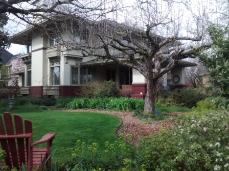
At 35th Avenue turn right and then quickly turn left again onto Beakey Street. On the right is the Zimmerman-Rudeen house. This house, built in 1913, is a great example of the Prairie style of architecture originating with Frank Lloyd Wright and other turn-of-the-century Midwest architects.


Continue on Beakey Street. Beyond the Zimmerman-Rudeen house you will see these two homes on the right. They are both new construction, in 2013, and both are on lots half the size of those in the rest of the neighborhood. Undoubtedly this site contained one home until recently, when it was torn down and replaced with two. This is becoming a common occurrence in older, desirable Portland neighborhoods.

Beakey Street ends at 33rd Place, so turn right onto 33rd. At the corner is this unique Norman revival home with a turret. While not as common as Dutch colonial and other styles popular at the time, this style does pop up occasionally in early 20th century middle-class and high-end neighborhoods.


After one block on 33rd Place turn left onto Fremont Street, and after two blocks turn left again onto 32nd Avenue. Head down the hill on 32nd for seven long blocks. The route leaves the Alameda Ridge, a result of the cataclysmic Missoula Floods at the end of the last ice age, and heads down into the Grant Park neighborhood. The houses, are somewhat more modest in this neighborhood. The house pictured is typical of a style popular along this street, with a steep pitched roof resulting in 2nd story rooms with some interesting ceiling angles.

Turn left onto U.S. Grant Place. The homes are now bigger again. The street signs identify this neighborhood as Dolph Park, but there doesn't seem to be any official neighborhood designation from the City of Portland, and the boundaries of Dolph Park vs. Irvington to the west and Grant Park to the east are unclear. The actual Dolph Park subdivision plat, created in the early 20th century, is centered slightly to the west of this intersection, at 31st Avenue and Brazee Street.

Continue on U.S. Grant Place for one long block. This is a street of large homes, the most prominent of which is the Haseltine House, on the National Register of Historic Places. This Georgian Revival mansion was constructed in 1935.


Carefully cross busy 33rd Avenue and continue to the left, along the right side of 33rd. To your right is Grant Park, a 20 acre site that also serves as the "backyard" of Grant High School, which is located in the large buildings farther to the right. The park has been here since 1922.


After the athletic field, take the short stairway to the right into Grant Park. You will soon come across these three statues, a boy, a girl, and a dog, and between them a fountain. The boy is Henry Huggins, the girl is Ramona Quimby, and the dog is Ribsy. All three are characters in Beverly Cleary's novels, and this park and neighborhood are in the middle of their stories. Recently Beverly Cleary celebrated her 100th birthday.

Continue through Grant Park along the pedestrian path. Eventually you will see a path diverging to the left toward an elementary school - go that direction. The elementary school is named for Beverly Cleary, one of two in the neighborhood.


Walk straight ahead on 35th Place from the school for two blocks to Stanton Street, then turn right. Continue on Stanton Street for 8 blocks to 43rd Street. This quiet residential street is home to many mature deciduous trees - a typical and welcome attribute in this neighborhood.


Stanton Street ends at 43rd Avenue - cross the street and head up the public stairs leading back up onto Alameda Ridge. There are 115 treads on this stairway. If you are interested in a real up and down stair experience on Alameda Ridge, Metro's Walk There series has a good route.


Once at the top of the stairs you are back on Alameda Ridge, On your left is the Tannler-Armstrong House, an English Cottage-style home built in 1924 and on the National Register of Historic Places. This large house was originally built for a childless couple, and thus has only two (presumably very large) bedrooms.


At the top of the stairs, turn right on Alameda Street. The first house on the right, separated from the Tannler-Armstrong House, is the Crum House, built in 1926 and also on the National Register of Historic Places. The house is a mixture of historic styles, including French Renaissance and Gothic Revival. It was designed by Portland architect Leigh Dougan, who got his start as an office boy in the Chicago office of Frank Lloyd Wright. The original owners, Virgil and Beulah Crum, were, like their neighbors in the Tannler-Armstrong House also childless. After passing the Crum House continue on Alameda Street for several more blocks with its stately homes.

Turn left onto 48th Avenue and head north. The homes along these streets are more modest than those along Alameda. Amidst the bungalows and various colonial-type historical revival homes sits this Spanish-style home on the left. There are a few homes of this style scattered in Portland's 1920's neighborhoods.


Later on 48th Street you will come upon this home, constructed within the past couple of years. The new homes plopped in Portland's historic neighborhoods tend to be either craftsman-style bungalows or starkly modern homes such as this one. You be the judge as to whether this new home complements or distracts from the neighborhood. Continue on 48th Avenue to Fremont Street and the Alameda Brewing Company, where you can enjoy a beer to celebrate finishing this walk.

About Me

Blogs about biking and walking in the Pacific Northwest